Tools - spatial assessment & visualisation
Tools that evaluate and represent urban space conditions and intervention effects.
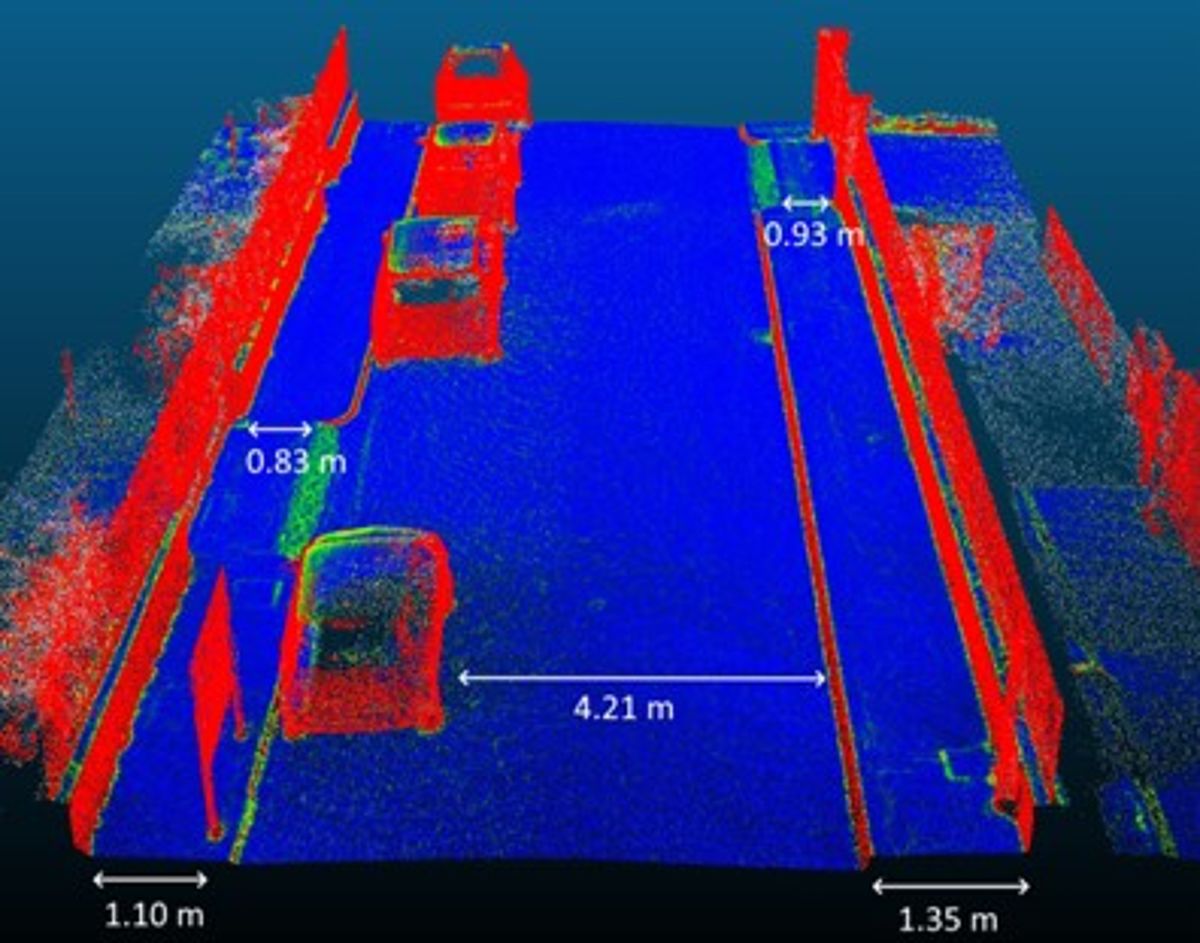
Sidewalk scanner
Tool for assessing the quality, accessibility, documentation and visualisation of public space.
LiDAR technology that allows the creation of point clouds that can be used to visualise existing sidewalks, levels of quality and accessibility and possible alternatives. It can generate a map of data of any given location and can be integrated with GPS, GIS and other tools. Also valuable for pre- and post-evaluation of interventions.
Cities that will use this tool:
Zagreb, Bologna, Utrecht, Heidelberg, Lyon, Budapest and Gothenburg.


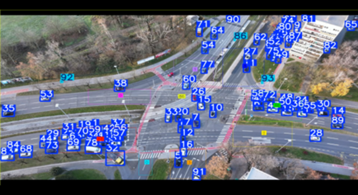
Road space modelling with AI and 3D space
Computer vision tool for detecting, tracking, and counting pedestrians, cyclists, and vehicles in drone videos of street intersections.
This tool analyses drone videos from a street intersection to detect and track vehicles, pedestrians and cyclists, counting how many pass through and in which direction they move.
Cities that will use this tool:
All REALLOCATE project lead and twin cities + Strasbourg.


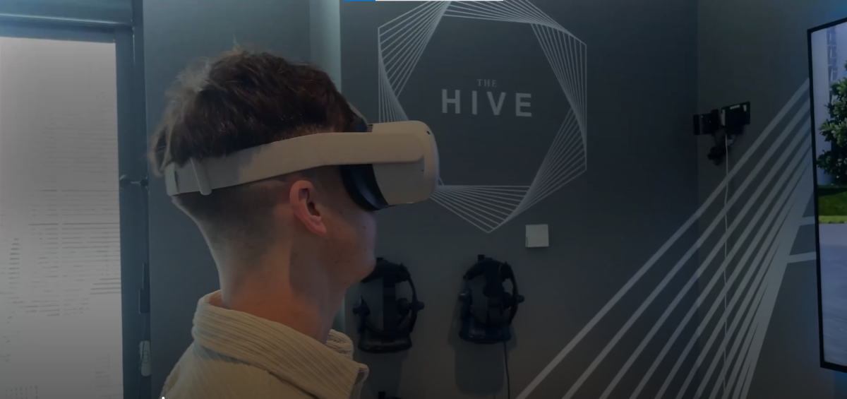
VR from a child’s perspective
This tool is an excellent way to visualise proposed changes to the streetscape.
In the process of creating this tool, a 3D model has been developed of a “before” scenario and an “after” scenario for school street interventions in Warsaw. This included the development of a VR app which was published onto the VR headsets. This can also be used as a tool to illustrate the outcomes of a co-design workshop.
Cities that will use this tool:
TBD.


This project has received funding from the European Union’s Horizon Europe programme under grant agreement No. 101103924. Views and opinions expressed are however those of the author(s) only and do not necessarily reflect those of the European Union or the European Commission. Neither the European Union nor the granting authority can be held responsible for them.


REALLOCATE is a project under the CIVITAS Initiative, an EU-funded programme working to make sustainable and smart mobility a reality for all, and contributes to the goals of the EU Mission Climate-Neutral and Smart Cities.